The Great London Pond Project is a partnership project between the Zoological Society of London, Freshwater Habitats Trust and GiGL, and is supported by the Mayor of London. The wider aim of the project is to restore and increase the number of vital pond habitats for London. To do this, the first step of the project has been to map and assess the condition of ponds across Greater London with the help of community science volunteers.
What is a pond? What is a priority pond?
For the purposes of this project, we define ponds using the Freshwater Habitats definition of a pond, which is ‘a body of standing water between 1 square metre and 2 hectares in area, that holds water for at least 4 months of the year’.
Priority ponds are those which have a particularly high conservation value, usually because they support important freshwater species or rare community types (Freshwater Habitats Trust, 2024). The national expectation is that 20% of ponds will be priority ponds. The Priority Pond Assessment Survey, or PASS survey, is a survey that can be used to identify a potential priority pond. By collecting data on variables such as surrounding land use, isolation, plant cover and shading, the PASS assessment can predict if a pond would be likely to be a priority pond upon further investigation of the plant and animal biodiversity.
Overall Project aims
- To map and assess the condition of ponds across Greater London.
- To ground truth the existing standing water dataset for ponds that GiGL holds.
- To contribute to the wider Freshwater Habitats Trust Priority Pond Project.
Training
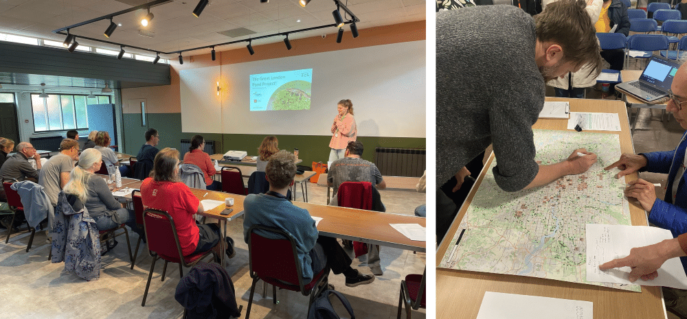
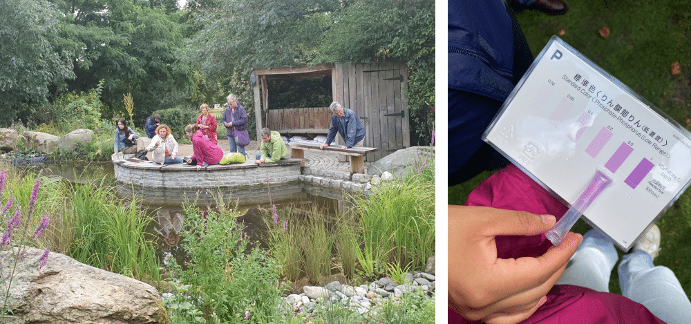
Over the course of the project, from April to the end of September, we carried out 8 training sessions and trained 100 volunteers in the survey method (Figure 1). Some of these volunteers were also trained in how to use Kyoritsu Phosphate and Nitrate kits to measure the water quality of ponds (Figure 2).


Outcomes
At the start of the project, GiGL provided their current dataset on publicly accessible standing waterbodies in London, of which their map showed 2745 data points where it was thought there could be ponds, with data taken from a range of timeframes and projects.
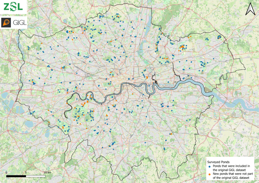
Thanks to the help of our brilliant volunteers, 1173 data points out of the original 2745 were processed over the course of the project. Most were processed by on the ground volunteer or staff surveys, with a small number of points also processed by using Google Satellite imagery to determine that they would either be inaccessible (e.g. golf courses, schools), or not ponds at all (e.g. points that were in the Thames, docks, sewage works). Of the 1173 points processed, 418 (35.6%) of the ponds were confirmed to be ponds. In addition, 163 new ponds were mapped which were not included in the original GiGL dataset. All 581 ponds that were surveyed are shown in Figure 3.

How many were priority ponds?
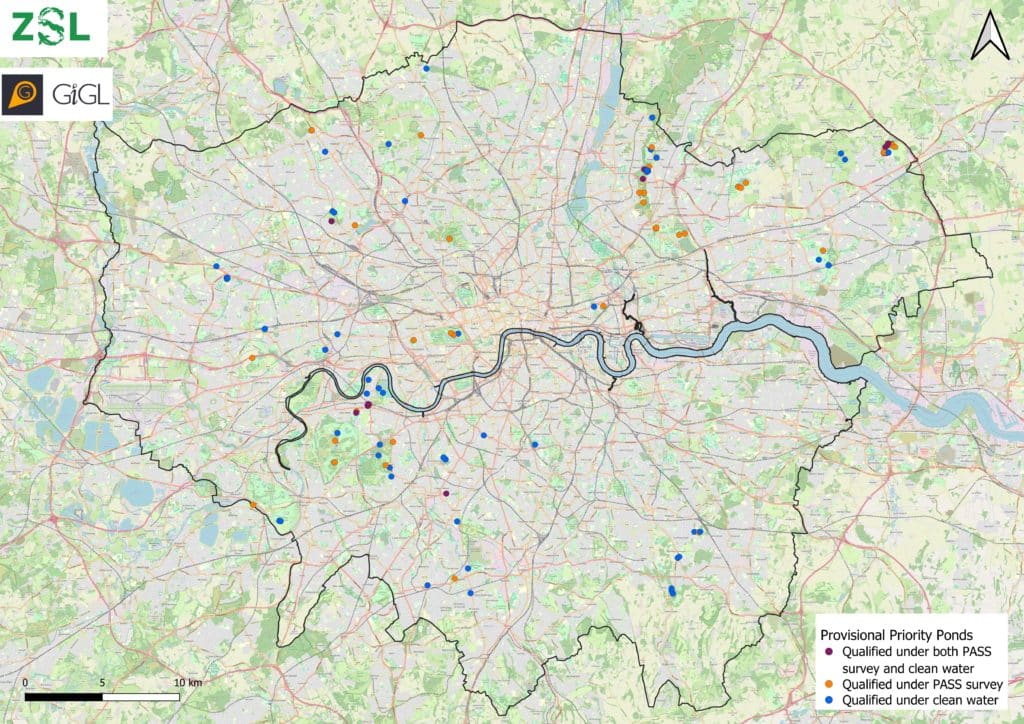
Of the 581 that were put through the PASS calculator, 58 qualified as provisional priority ponds (Figure 4). Provisional priority ponds can also be identified from water quality results. For a pond to qualify as a provisional priority pond under water quality, both nitrate and phosphate need to be at low levels, with nitrate levels below 0.5ppm and phosphate below 0.05ppm. Therefore, according to our results, out of the 171 ponds tested, 71 ponds qualified as provisional priority ponds based on water quality results alone. 17 ponds qualified under both PASS and water quality, meaning there were 112 separate provisional priority ponds across London. Closer investigation will be needed to verify their priority ponds status, but this gives some indication that ponds remain an important habitat in London, and understanding where these vital habitats are is key so that we can continue to protect and manage them for wildlife going forward.

Next steps
The next step of the project will be to forge new partnerships with landowners and community groups to start restoring ponds that this initial survey shows are disappearing from our cityscape. These habitats are too important to let go, and their restoration will be an important part of a wider nature recovery plan for London.
The pond survey results will also be fed back into GiGL’s London wide Habitat and Land Use dataset, which forms an essential baseline for a variety of projects and outputs, including ecological network mapping, Biodiversity Net Gain (BNG) and London’s Local Nature Recovery Strategy (LNRS).
If you have information or data on ponds in your borough that you would be happy to share, it would be great to hear from you! Please contact me at Elizabeth.witcombe@zsl.org.
Sources:
Freshwater Habitats Trust (2024). Priority Ponds. Available at: https://freshwaterhabitats.org.uk/our-work/conservation-and-practical-delivery/habitat-protection/priority-ponds/ [Accessed: 14th October 2024].
