Maria Longley, GiGL Community Manager

Photo credit: Dialysis Technician Salary
GiGL’s flagship report, the ecological desktop study, presents a snapshot of the GiGL Partnership’s knowledge of a site or an area. The report is the culmination of a lot of time and effort to collate information about the whole of London; so we wanted to lift the lid on the process of what goes into creating this report. All of the team members contribute in one way or another to the ability of GiGL to run this specialist biodiversity data service.
More than just a simple data retrieval process, the data search service is built on the knowledge and collective effort of many individuals and organisations. The report showcases the best available ecological information to help realise a site’s potential or historical value. From its inception in 2001 we have delivered thousands of reports to meet our vision that London’s natural environment is appreciated, understood, considered and improved.
The data search report is a crucial tool in London to enable biodiversity data is considered in the planning process. The data journey from people’s observations and notebooks, through to GiGL databases; and the information is then shared wide and far. There are a lot of people involved in this data journey and GiGL only play one part in the “life cycle” of biodiversity data in London. While the data are with GiGL, the whole team play many varied roles to ensure that they are the best they can be to inform the next uses. These core datasets form the backbone to many crucial services and the GiGL team are proud to look after them.
Meet the team
Much in the same way that the GiGL reports are meant to provide context for a client to appraise a site and be an addition resource to their professional expertise, GiGL’s work on this service reflects national work on considering biodiversity in planning.
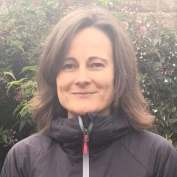
Mandy Rudd, Chief Executive
I set up our data search service in 2001 and our experience since then has been that there are consultants that work to best practice, and those that don’t because it’s cheaper to ignore it. The latter aren’t doing a good enough job for nature in our city and we have been collaborating with other organisations over the past 10 years or so to raise awareness of the issues, opportunities, and importantly what to do if an applicant has breached licence conditions by using ‘free’ resources instead. Our aim is to help create a more level playing field for users of our service who tend to be following best practice, are committed to doing a good job for nature and in turn their clients.
In 2010 I wrote a paper for a National Forum for Biological Recording council meeting that set out the key challenges to Local Environmental Records Centres’ (LERC) data search services. The paper led to discussions with the National Biodiversity Network Trust because of the unauthorised use of the Trust’s Gateway by potential LERC clients who were bypassing our services and breaking the Trust’s terms and conditions. These discussions also brought in the Institute of Environmental Ecology and Environmental Management (now CIEEM) who convened the Biodiversity Data Users Group in May 2011 to address these issues. The group still meets, and its focus has been to encourage closer collaboration and understanding amongst key sectors in relation to curating and using biodiversity data.
Our Natural England-funded planning project in 2011 resulted in evidence that highlighted a considerable gap between what national and regional policy-makers assumed was being done to consider biodiversity in the planning process, and the reality of what under-resourced planning authorities were able to deliver. Our experience helped shape the Bat Conservation Trust’s bid to the Esmée Fairbairn Foundation for the Partnership for Biodiversity in Planning project, which saw us join 18 other organisations on the steering group of a project that aimed to improve the consideration of biodiversity in the planning process https://www.biodiversityinplanning.org. We also used the 2011 findings to raise awareness of the lack of evidence-based applications in London, which led to the Greater London Authority commissioning the planning research work mentioned by Eleni (see below).
Much of my subsequent work around LERC data search services has been at a national level via the Association of Local Environmental Records Centres in relation to biodiversity net gain and the ongoing issues with potential LERC clients breaking licence terms to use data published for non-commercial use on the NBN Atlas. However I do still take the opportunity to use our statistics (https://www.gigl.org.uk/planning-for-nature/data-searches-and-planning) whenever I can at a London level (cue much eye rolling), for example in informing our responses to the Mayor’s London Environment Strategy and London Plan consultations because we firmly believe that the number of data searches that we deliver annually is a great indicator of how national and regional planning policy and related best practice is being implemented.
Data search reports, more often than not, highlight the presence of otherwise difficult to obtain species and sites information. GiGL receive data in many diverse formats so one challenge the team members face is standardising it so it can be compared across London. There is also a fair amount of detective work that goes into tracking down missing data! Data management is a skilled and varied task.

Laura Kuurne, Database Officer
My role at GiGL is focused in managing and developing our sites datasets, including Sites of Importance for Nature Conservation (SINCs), open spaces and habitats. There are various works involved to keep these data robust and up-to-date, and the updating process is different for each dataset…
My role at GiGL is focused in managing and developing our sites datasets, including Sites of Importance for Nature Conservation (SINCs), open spaces and habitats. There are various works involved to keep these data robust and up-to-date, and the updating process is different for each dataset.
Designated sites data such as SINCs reflect local planning policy, and the updating process includes researching Local Plans, collecting data from local authorities and standardising the data. In comparison, our open space data validation and verification involves comparing site polygons to Ordnance Survey’s (OS) Master Map data, aerial photographs, and information found online to verify that the site boundaries and the associated attributes are correct and they have not changed over time. I also consult an external working group and experts to develop definitions relating to our open space data. This ensures that we, and everyone in London, maintain robust and analysable data that can be used to support services such as ecological data search reports.
Data management at GiGL also includes finding new ways to use and develop existing data to make sure they match the current needs for our partners and stakeholders. A good example of this is our brand new habitat database, which translates and stores the legacy of information from London’s rolling borough-by-borough habitat surveys (1984-2008), subsequent local surveys since and OS land use data.
Creating a data infrastructure around biodiversity and planning is a vitally important task. The Open Data Institute point out that “trustworthy data infrastructure is sustainably funded and has oversight that provides direction to maximise data use and value by meeting the needs of society.” A new GiGL project is researching how planning authorities currently use biodiversity data.
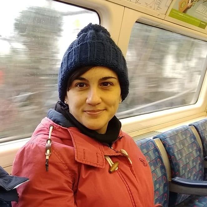
Eleni Foui, Planning Research Officer
In 2016, the Mayor of London’s “Planning for Biodiversity?” project concluded that c.18% of planning applications in Greater London, during a one year period, should have been supported by a biodiversity data search since they met at least one of the set biodiversity criteria (Table 1 in the report). However, only about 1% of validated applications were found to have been accompanied by a GiGL data search report.
In response to these findings, GiGL has launched the Planning Research Project, with support from the Greater London Authority, and have created the Planning Research Officer role to carry out this project.
As GiGL’s Planning Research Officer I am examining the current practices at London’s Local Planning Authorities, identifying best practice among them, the challenges they face and their needs in relation to taking into account biodiversity in their decision making process. Our aim is to support Local Planning Authorities, through relevant guidance and training, to deliver better outcomes for biodiversity by utilising biodiversity data in the early stages of the planning process. As a result, planning applications requiring a GiGL data search, as well as further ecological information (e.g. Preliminary Ecological Appraisal, Ecological Impact Assessment etc.), will be identified during these early stages in the planning process.
Ideas, trends and reports change over the years and GiGL has invested in the systems and tools that allow us to delivery our service. Data quality and standards play an important part in the data infrastructure, and GiGL has been involved in writing national standards as well as working locally to help clients with their compliance requirements.

Andy Foy, Systems Manager
I first worked on the data search service in 2004 as an interim Data Officer. Back in those days compiling GiGL reports was very much a manual process with lots of repetitive and tedious steps. So, as a side-line, I worked on streamlining and automating may of the steps so that we could spend less time compiling reports and more time on inputting, managing and improving the data captured within them. But this was long before the introduction of superfast broadband, so we still had to print, bind and send the reports in the post. Thankfully things have moved on since then.
Now as Systems Manager, my focus now is on supporting and enhancing all of GiGL’s systems and datasets to further improve their quality, usability and accessibility. This can range from writing simple queries to view the species, sites and habitats data that we hold in different ways; creating tools to bring that data together so that they can be combined and analysed, such as in a GIS application; or developing new databases and applications to store biodiversity data more efficiently in ever greater detail and with improved standards, such as with the new GiGL habitat database.
One of the applications that we rely heavily on is Recorder 6. It is designed for entering, collating and exchanging records of species observations, and it is used by many individual recorders, local and national schemes and societies, and Local Environmental Records Centres (LERCs) like GiGL. For many years the development and support for Recorder 6 was provided by the Recorder 6 Consortium who were funded by the JNCC; but in March 2018 the JNCC stopped all financial and administrative support. Since then a new steering group, representing the Recorder 6 user community, was formed to work with the Recorder 6 Consortium and safeguard ongoing support, funded by a new licence fee arrangement.
Another key component of the data infrastructure is the trustworthiness of the data. At the heart of that are the many relationships built up over the years between data curators, providers and users. Technology and new processes to capture data are going to be an exciting part of the data infrastructure, but it is vital that people are not removed from the ongoing conversations.

Lyndsey Cox, Senior Community Officer
I have worked with species data for as long as I’ve worked at GiGL (16 years and counting), which means that I’ve also worked with species recorders and verifiers for that length of time.
These long-term relationships are important to us at GiGL. It means we have built up a wide and varied group of organisations and individuals who send us their species data, and we also have a fantastic group of verifiers who help us with verification (e.g. https://www.gigl.org.uk/verifying-odonata). These same verifiers have also recently worked on updating the London Priority Species List; a list of species which are considered under particular threat in London and which planning applications must take into account.
In addition to recent records, many organisations have historic paper records which require digitising, something we are particularly fond of doing (https://www.gigl.org.uk/show-tell-mobilising-paper-records/), and where the numbers are just too great, citizen science lends a hand (https://www.gigl.org.uk/the-zooniverse-of-london-birds).
I’ve digitised 20,000 moth records myself (https://www.gigl.org.uk/masses-of-moths) and have now inputted a much larger number than the 1.5 million records mentioned in the linked article. Thankfully a lot of these have been spreadsheet-based but we happily receive records in any format, always ensuring that data standards are upheld. Both validation and verification processes are standard procedure for GiGL data (https://www.gigl.org.uk/giglpolicy/validation-verification-policy).
GiGL waive its fees for many community organisations and individuals to give them access to GiGL services which helps us connect with a variety of groups and individuals from a diverse set of backgrounds. The connection we have with recorders and verifiers and their diversity is clearly shown in the Joy of Recording GiGLer articles. These are written by recorders with links to GiGL and have a clear love for the natural environment and wildlife recording.
Recorders and verifiers are an integral part of the GiGL world and a vital cog for anyone wishing to discover more about London’s wildlife.
As London’s Local Environmental Records Centre GiGL is involved in a multitude of networks that range from small and local, to London-wide and national. GiGL works hard with key partners to level the playing field for environmental consultants by creating a shared expectation of when Local Authorities need to see a data search report with a planning application and how the available data should be interpreted in the London context.

Chloë Smith, Partnership Manager
At this year’s NBN Conference, Sandy Knapp, President of the Linnean Society of London, was asked after her keynote address for her secret to developing a functional network. She replied firstly that you need to like people! The audience chuckled, recognising the truth of this: information can flow through networks, but people make the connections and interpret the evidence. Working in partnership, GiGL handle data every day but much of our activity involves talking with people, understanding their needs and facilitating their work by linking data with answers.
As Partnership Manager, my role is to co-ordinate and maintain our relationships with organisations that have Service Level Agreements (SLAs) with GiGL and seeking to foster new and stronger relationships. The data search report service is primarily accessed by GiGL clients, but they may in turn be working with, or reporting to, GiGL SLA partners as part of the planning process. We regularly attend the London Boroughs’ Biodiversity Forum and maintain strong relationships with many local authority partners, providing an opportunity to check the flow of GiGL information between planning applicants, their ecological consultants and local authority decision-makers works.
Through partnership dialogue, the team and I influence key stakeholders so that they expect to see evidence of consultants interpreting a GiGL report with relevant applications; we assist partners to understand the terms of use and possibilities (and limitations) of the information, supporting their interpretation of applications; and we listen to the needs of our local authority partners as well as client users of the data search service, to help us develop report content.
Collect data once and use them many times” is a well-worn GiGL saying. Naturalists going out to observe the wildlife in their local environments are rarely doing so because of the planning system in the UK. Through talks and meetings GiGL speak to the species recording community about the many uses of the observations they make and advocate the value of reusing the observations. Getting notable and protected species highlighted in the data search report, and therefore available for consideration in the planning process, can be a motivation for recorders to share their data once they hear of how it is used in London.

Benjamin Town, Community Officer
As well as individual recorders, GiGL rely on the brilliant work of community groups for species data. We provide the ability for groups to use GiGL systems as a database to collate and organise data from their site of interest as many groups don’t have the capacity to put all their data in one place. Whether we achieve that by storing their records in our database or collate information about their space online like the Big Green London Map project, we do our best to support groups and foster the relationships with our community.
Larger groups are often able to carry out regular monitoring of a site and this provides very different information to one-off surveys or incidental records. Although both types of data have their uses, having groups dedicated to their own greenspace provide greater accuracy of the data as they capture the detailed and expansive local knowledge accrued by the recorders from their years of surveying the same site. Our latest Joy of Recording article on Warren Farm perfectly encapsulates the relationship between a recorder and their greenspace (https://www.gigl.org.uk/joy-of-recording-7/).
In our efforts to support recording in every facet, we give advice on and create forms for recording wildlife for other groups and organisations, lending our expertise and creating the best conditions for records to make it into the data search reports.
GiGL’s data services encompass more than just this data search report. Other services may be a bespoke data investigation to answer a specific question from a GiGL Partner or creating a map of youth related open spaces for a dance group in Camden, but they often have a way of winding up as new services in the report too.

Emma Knowles, Partnership Officer
My role as Partnership Officer involves providing data, maps and visualisations, information, statistics, and advice to our network of SLA Partners, as well as work on our core datasets. Exploring our database to find the answers to the great variety of questions that we are always being asked about London’s wildlife and open spaces has enabled me, and all of us at GiGL, to develop in-depth understanding of the data: we know the coverage, history, advantages, limitations, permissions, quirks and top tips for all our datasets (plus an assortment of relevant external ones), and can provide explanations and insight beyond what is immediately apparent from the GIS files and spreadsheets.
Assessing new data can involve checking datasets down to the very last detail and I always investigate whether everything makes sense; if maps look right, attributes are consistent and the numbers add up before proceeding (earning the nickname “Detective Inspector Knowles”). For example, we are currently working on screening each individual SINC access point, especially in areas where things are likely to have changed, to model a more accurate AoD to SINCs dataset.
Alongside team members, I helped to develop a system and guidelines for TfL’s biodiversity monitoring project so that TfL contractors who receive GiGL data searches can feed back the new habitat data that they collect in their site surveys, along with their planned changes to the site. This means that we can measure TfL’s impact on habitats independently on their behalf, and we can improve the GiGL habitats dataset for the GiGL Partnership.
Last year, I led a project with CPRE London to complete the London-wide map of Metropolitan Open Land (MOL) and update the map of Green Belt. As with our SINCs database, this involved persuading all 32 boroughs, plus the City of London and the London Legacy Development Corporation (Olympic Park), to provide their designation boundaries and eventually, we succeeded (https://www.gigl.org.uk/mapping-londons-green-belt-and-mol/). Our Database Officer Laura has been following up with all the boroughs to keep the GiGL MOL and Green Belt data completely up to date, making them reliable and comprehensive enough to include as evidence in our data search reports for the first time.
GiGL actively uses these incredible datasets for data modelling, map making, and other projects to inform decision-makers, land managers, policy-setters, curious students, media outlets and many more in London. GiGL’s core datasets are the backbone of an astonishing array of outputs that are informed by, or created for, partners and clients. Listening to the people and organisations around GiGL is a common thread of these projects.

Minhyuk Seo, Partnership Officer
As GiGL’s Partnership Officer I represent GiGL at partnership meetings to advise on data flow, use and standards during a project’s decision-making process. GiGL are often involved with local Biodiversity Action Plan drafting processes and project-funded working groups by providing correct and current environmental data and advice to help identify and improve London’s natural environment. We are also involved with regional-level partnerships such as The London Tree Partnership where we advise on how to collect, manage, and analyse data to help improve and monitor the capital’s woodland habitats and tree cover.
Providing environmental data advice requires us to understand as much as we can about the data; how it should be stored, managed, used, but more importantly understanding where the data comes from. We often request our partners and consultants to help us get a better idea of how the data is collected by shadowing them on their surveys: phase 1 habitat surveys, open space surveys, species recording, to name a few. Understanding how the data is collected on site ensures our datasets and processes work well alongside data collection practice, streamlining the process in which the most current and accurate data is implemented into our database and included in our data search reports.
Another part of my role is to identify how best we can use GiGL data to help our partners answer some key questions about London’s natural environment. Having led the project since the start of 2019, I helped GiGL publish the Biodiversity Hotspots for Planning dataset on the London Data Store (https://data.london.gov.uk/dataset/biodiversity-hotspots-for-planning); an open dataset indicating where records of protected and priority species, sites, and habitats are most concentrated in Greater London.
Using our network of partners, I gathered expert advice to create a dataset that illustrates how the evidence base relates to planning policy by displaying multiple layers of points and polygon data into one snap shot. Developers, consultants, homeowners and local planning authorities can access this open data to identify how planning applications relate to biodiversity data hotspot areas and raise awareness of available data for decision-making. Consultants and other clients may access a more detailed version of the dataset with the appropriate data use licence. GiGL will continue to try and discover new ways to present our data to answer key questions about London’s environment.
The costs of the report relate to the data management involved, not to the data. As a social enterprise the profit GiGL makes has to be reinvested in the core purpose of the organisation. By using the data search service environmental consultants are also investing in the support GiGL is able to provide local recorders.
Maria Longley, Community Manager
My role centres very firmly with the intersection of people and data; getting the most out of existing data as well as supporting the people who do wildlife recording in London. Excitingly, each of those records represents a meeting between humans and wild species in the capital, and bringing these records together creates a rich picture of the coexisting success, and some failures, of observing urban wildlife.
Through our partnership work we do a lot of advocacy in London and beyond to represent data user’s and provider’s needs. Ongoing discussions include open data, making sure the data is flowing around everywhere it needs to go, ensuring that we are part of trustworthy sources of information in London, and that we respond well to the changing interactions between humans and technology.
One of the ways we are investing in recorders in London is by organising an annual conference for everyone interested in wildlife in the city to attend. This is a great opportunity to celebrate all that is going on as well as providing a forum to exchange ideas, and we enjoyed another successful event this year. On a national level, I am involved with the National Forum for Biological Recording which provides an independent voice for recording in the UK. People are really doing amazing things for nature in London and it is important to reflect the views and opinions of locals in the data reports we create.
