A GiGL service level agreement (SLA) comes with access to GiGL data holdings, as well as various information and answer services. With an SLA, GiGL partners receive data updates for internal use every 3 months and can ask the team for bespoke data provision, interpretations, and visualisations, as well as recording support and engagement, and data related advice and consultancy.
Click the service categories below to find out more, and scroll down to see our introductory video. Read more about the benefits of joining the GiGL partnership, or get in touch with GiGL’s Partnership Manager, Julie (julie.cox@gigl.org.uk), to discuss becoming a GiGL partner.
Contractors:
Contractors to partner organisations can also access the same data and services, provided they contact us directly and complete a Data Use Licence. There is no additional charge for this service. Don’t forget that GiGL might be able to carry out some, or all, of the work you are contracting either under your SLA or as a separate contract, so please enquire.
Current SLA Partners:
View our current list of partners here.
If you’re a current SLA partner looking to commission work or request data, please fill in our online request form. We process partner requests within 10 working days, and usually faster. When this is not possible because of the complexity of the request or the nature of the project, we will arrange a suitable project outline and timeline with the partner.
Please note that projects with external funding or multiple partners – e.g. HLF funding bids – may not be covered by the SLA of an individual participating organisation, and will usually require a GiGL SLA or project funding of their own. It is important that GiGL costs are factored into funding bids (as per our costing contracts guidance) for projects with external funding. Please contact slaenquiries@gigl.org.uk to discuss the work and request a quote.
Data provision
- Our quarterly ‘data exchange’ keeps you updated with changes to the GiGL core datasets for your area, plus a buffer, in full resolution GIS format. You can request ad hoc tailored data extracts for your projects at any time. These data are only available to GiGL data use licence holders at full resolution with comprehensive attributes; a licence is provided with your SLA. In addition, we provide you with standardised copies of third-party datasets for context, including statutory sites data for your area.
The shared data licence limits use to internal business, and onward sharing and publication is prohibited. Any breach of the licence will incur a penalty fee that recoups the full cost of data stewardship and any potential lost earnings, which will be calculated based on figures outlined in the GLA’s planning research from 2016.
- The data exchange is also a two-way process. We will regularly ask you for updates to survey data and policy information you manage, so that we can add those to the London-wide databases on your behalf. This process ensures your data are managed safely and appropriately within London’s standard environmental data holdings and reflected in data outputs for other licenced users and within our planning reports. It also helps our Local Planning Authority and land manager partners to meet the Mayor of London’s expectations for data management in the London Environment Strategy.
- Provision of data to consultants working for partners.
GiGL are happy to share data only when the consultant is offering a service GiGL is unable to perform. This ensures our partners are not ‘double paying’ for services.
Please contact Partnership Officer, Molly (molly.wilcross@gigl.org.uk), for further information about the GiGL Data Exchange.
Data Interpretation
Data insights, statistics, analysis, and modelling.
Examples:
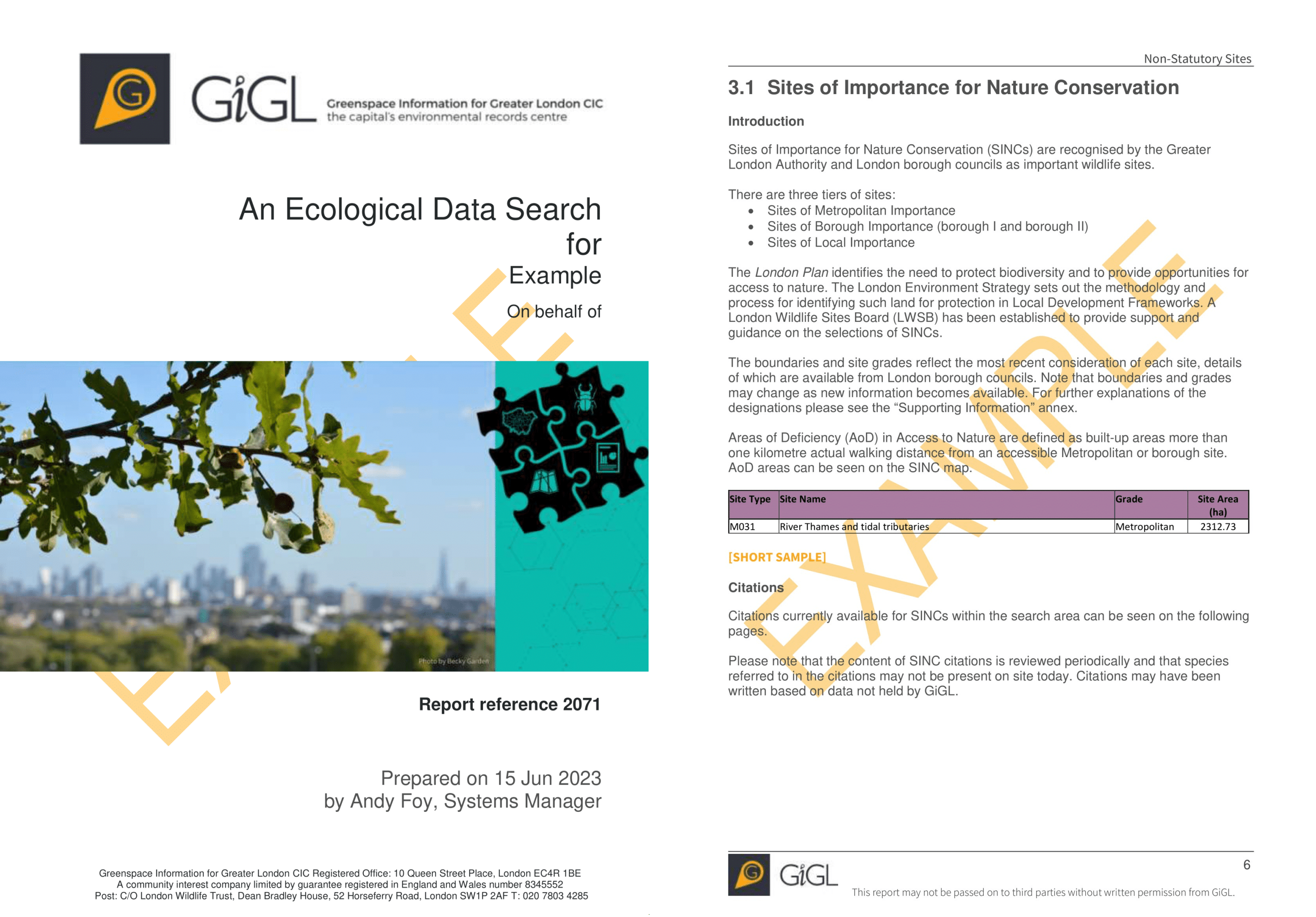
Data Search Reports
For those seeking robust biodiversity and open space information for a specific site and it’s surroundings.
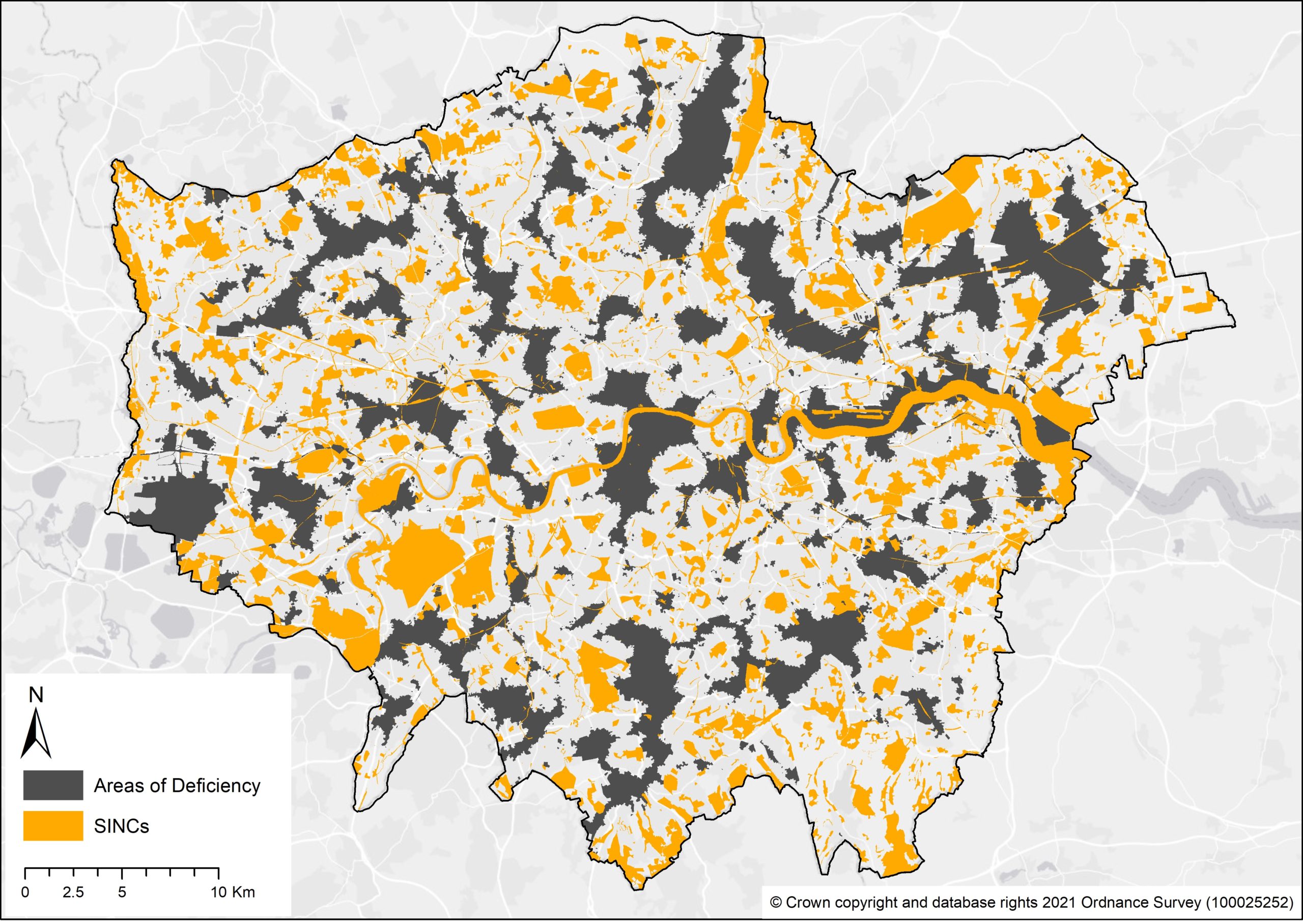
Areas of Deficiency
Modelling of AoD in access to Nature (SINCs), and AoD in access to Public Open Spaces.
Visualisation
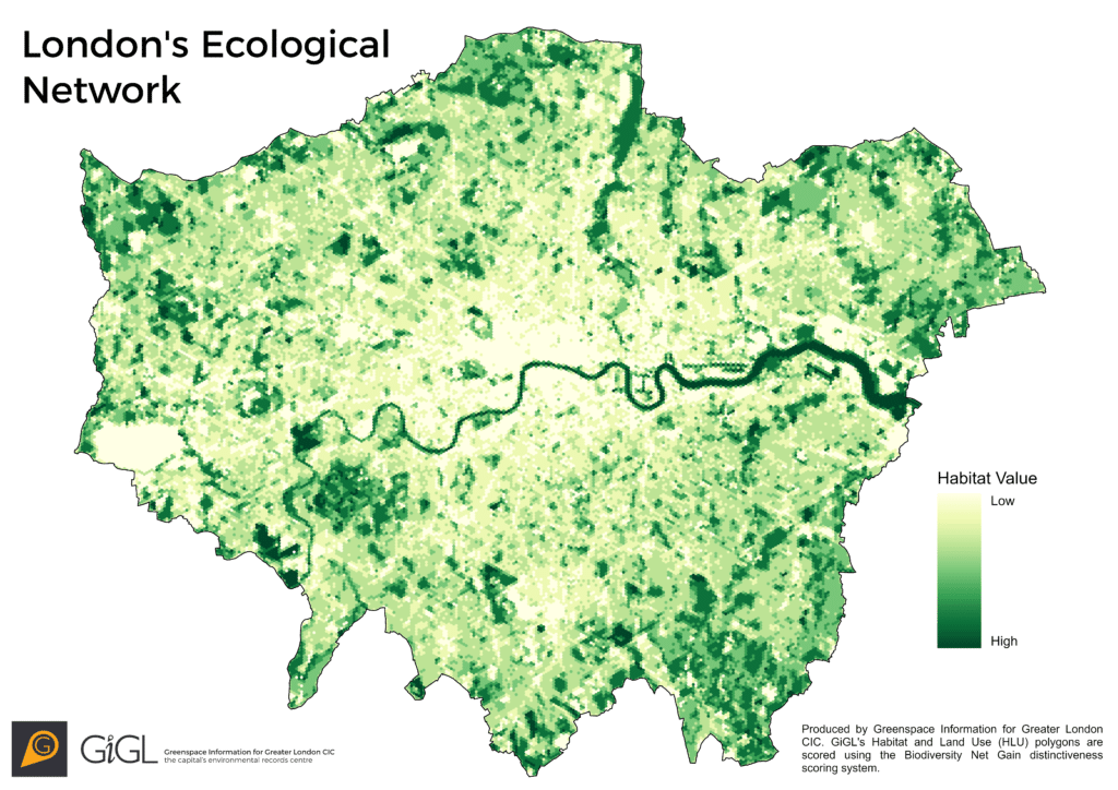
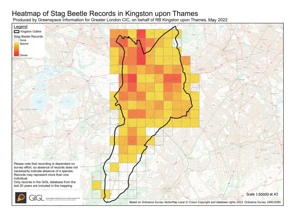
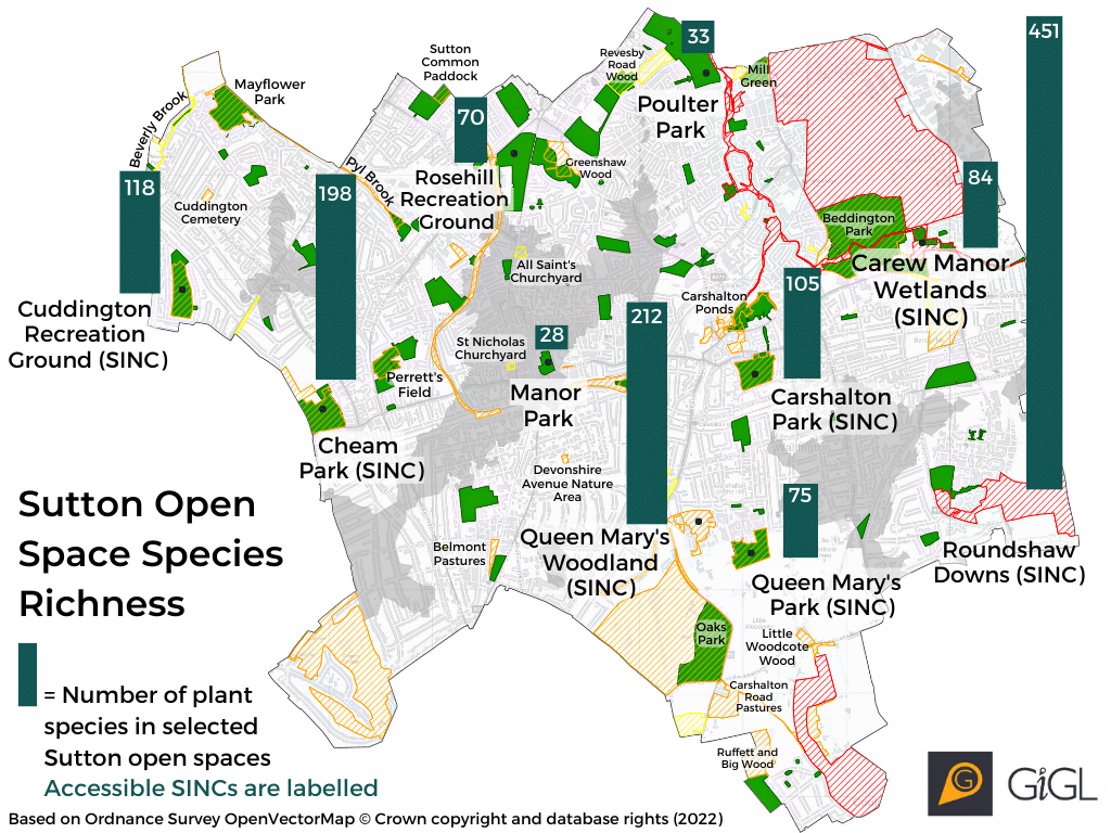
- Mapping of habitats, open spaces, designated sites and species.
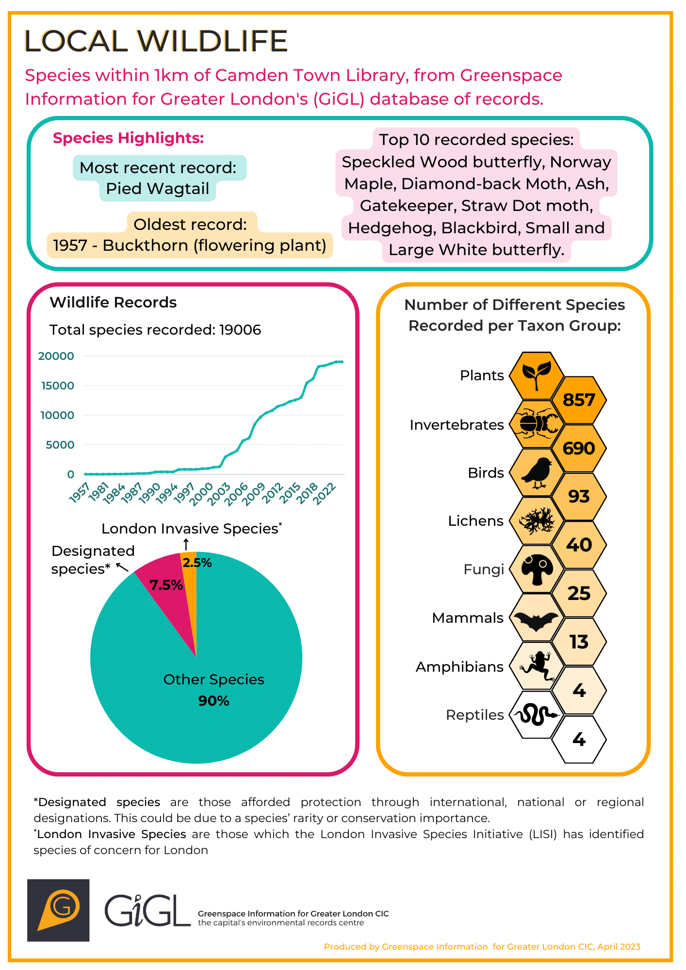
- Infographics of data insights and statistics.
- Posters and factsheets.
Support & Engagement
- Tools for data collection e.g. online forms
- Event attendance
- Resources for events e.g. posters and factsheets
- Partnership on internally funded projects
- Advocacy e.g. social media support
Advice & Consultancy
- Advice on the use and interpretation of GiGL data and products.
- Training and mentoring on the use of GiGL data and products, including GIS software.
- Survey data standards guidance
- Planning and policy support
- Statutory compliance
Additional Services
The following additional services are available but are charged separately to the SLA
- Provision of data services for areas outside of the partner’s agreed SLA boundary – this is usually the partner’s geographical remit plus 500m. We will not provide raw data for areas outside of the SLA boundary.
- Consultancy, including supervision of external consultants’ work on partner contracts – it is important that partners consult GiGL before employing consultants to check what we can contribute to projects. Any work completed for consultants as part their contracts with partners, for example providing AoD maps, will be charged to the consultant unless agreed through prior consultation with the partner.
- Work on partnership or grant-funded projects – these will be charged at our partner rate on an hourly or daily basis. It is important that GiGL costs are factored into funding bids (as per our costing contracts guidance) for projects with external funding.
- Skills training and mentoring where it is not directly related to use of GiGL data or products, e.g. general GIS training.
- Management and update of data outside of GiGL’s core datasets.
- Access to additional services being developed, or to be developed, by GiGL.
- Display and management of partner or project data on Discover London.
- Academic support for paid researchers (PhD and above) working with partners.
- Design and delivery of ground surveys, for example to inform LNRS, GI strategies, etc. This could include:
- Level 01 – desk study – GiGL and open data assessed and combined to form best available data evidence base
- Level 02 – on-site assessment targeting POS, SINCs, other policy-related spaces or species
-
Level 03 – strategic site and feature selection, survey and ongoing monitoring


