Suzie Jackman, London Underground

© LUL
With more than one billion passenger journeys every year, the London Underground is an essential part of the daily lives of those who live and work in the capital. It sometimes provides the only “green” people see in London’s highly urbanised environment, and provides easy access to greenspace in areas of deficiency.
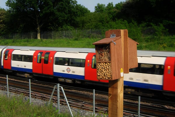
Most of the London Underground is over ground; stretching from Buckinghamshire’s Chiltern Hills in in the west to Essex’s Epping Forest in in the east. London Underground’s land acts as a green corridor allowing species to move around London and thrive on its relatively undisturbed land. A 2006 ecology survey identified many legally protected species and much of our land is within sites of importance for nature conservation.
London Underground published its first Biodiversity Action Plan (BAP) in 2007, with a review in 2010. Much changed in those three years but what hadn’t changed is the fact that biodiversity is still in decline globally and in the UK.
To prevent further decline, Natural England, and other conservation bodies, are moving from protecting small-scattered pockets, to managing much larger swathes of land. We at London Underground, as part of our 2010 BAP, are considering how we can support landscape scale-conservation.
The idea that we should identify and prioritise areas of our land for habitat enhancement to help further improve green space connectivity and increase the amount of BAP habitat in London was born. But how to do this?
GiGL’s habitat suitability maps provided the answer.
Where GiGL’s habitat suitability maps intersect with London Underground’s own ecology survey information, these areas are being prioritised for enhancement or restoration by London Underground during maintenance.
Making the use of habitat suitability maps “business as usual” is crucial to the success of our 2010 BAP. A detailed implementation plan has been developed to help do just that. The plan will identify the most appropriate UK Habitat Action Plan (HAP) habitat for London Underground property, given that management of some habitat types, for example burning of heathland, conflicts with the ability to run a safe and efficient railway.
Model habitat management plans will be an output of the habitat suitability maps too. For example, what does acid grassland look like? How should it be maintained? London Underground’s internal company management system will be updated with the right processes, guidance and training to ensure employees understand what is required of them. This includes instructions on how to monitor improvements and keep ecology information up to date – the most important piece of the puzzle for both London Underground and GiGL.
What GiGL did
Chloë Smith, GiGL Data Officer
The habitat suitability maps identify sites across London which include an area with biological suitability for maintaining, improving or extending a BAP habitat. This is based on existing biological data and expert consultation.
With nine habitats and three different management suggestions the dataset is complex – but it can be interrogated and the results simplified to provide what the user wants to know.
Once a site is highlighted by the BAP habitat suitability maps, how suitable it really is for enhancement depends on functional factors and the exact location of the habitat within the site. These factors need to be considered by other means.
Other GiGL partnership, or partner’s own, datasets can be used to help filter information further. Ultimately, decisions will be based on local site knowledge.
We cross-referenced a map of London Underground sites with the habitat suitability sites in a geographical information system. It was then possible to select information from the BAP habitat suitability data where it may be relevant to a London Underground site and append it to that site’s details.
The end result is a single layer of mapped data based on the London Underground sites familiar to the user, but incorporating new information about potential BAP habitat suitability for consideration at a local level.
