Little Britain is a lake, the shape of which resembles the map of the British Isles (hence its name). It is situated between the River Colne and the Frays River and was formed by gravel extraction in the 1930s (related sites include Mid Colne Valley and Lower Colne). The site includes several other former gravel pits nearby that have been landfilled and capped, and now support scrub and young woodland as nature slowly reclaims the land.This part of the Colne valley has a remarkable variety of habitats including lakes, rivers, scrub, areas of wasteland, woodland and neutral grassland. Included in the site are Fray’s Island & Mabey’s Meadow and Uxbridge Moor, both nature reserves managed by the London Wildlife Trust.
Local Wildlife Site
Accessible Sites of Importance for Nature Conservation
Little Britain
Borough: Hillingdon
Grade: Metropolitan
Access: Access on public footpaths only
Area: 64.51 ha
Description
Wildlife
The uncommon water plants, unbranched bur-reed and water dock both occur in the River Frays here. Of particular importance are the relict areas of floodplain grassland, so much of which has been lost in the Colne corridor. These support lush plant life including the nationally scarce tasteless water-pepper and London rarities marsh arrowgrass, marsh speedwell and sharp-flowered rush, as well as abundant ragged-robin.The lakes support various breeding birds and others join these to spend the winter here.There are also specially-protected water voles and recent reports of otters in the vicinity. The site is also of importance for bats, with noctule, Daubenton's bat and soprano pipistrelle all present in good numbers.Facilities
Information; car parking; fishing; toilets; cafes; picnic area; public art. The London LOOP passes through the site.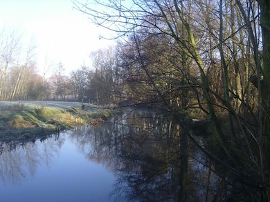
River Colne at Little Britain © London Wildlife Trust
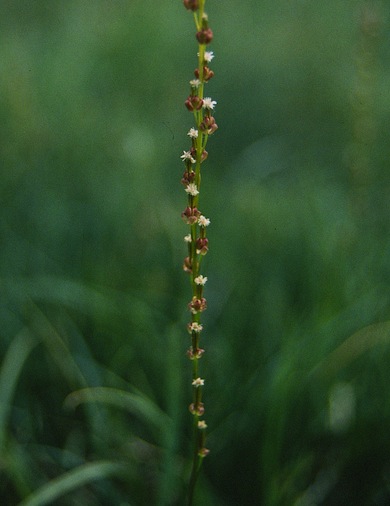
Marsh arrow-grass © Mike Waite
Feedback
Have a question or a comment for this site, or notice anything missing or out of date? Please contact us.